
Languages:
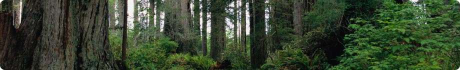
Box 6.1 FRA 2005 thematic study on forests and waterSince quantitative information on the role of forests in protecting water supply is rare, withfew statistics available, a qualitative thematic study on forests and water was carried outas part of FRA 2005. The report of the study is being completed for release during 2006. It highlights the following main points: Reduction of soil erosion as it affects water One of the most effective protective functions of forests is reducing soil erosion by water, which degrades water quality. Soil erosion on sloping land is generally of two major types: surface erosion and ‘mass wasting’. Forests have a beneficial role in both types. Surface erosion includes sheet, rill and small gully erosion, and is at a minimum in forests, with their understorey trees, shrubs and ground cover, and their forest floor debris. In fact, the small trees, understorey and litter protect soil from the impact of falling raindrops (soil dislodgement and splash erosion), overland flow of rainwater as a sheet, or channelling into rills and gullies (Hamilton and King, 1983; Wiersum, 1984). It is the removal of this ground protection, rather than removal of the tree canopy over 10 m high, that results in accelerated erosion. These uncompacted forest soils also have the highest infiltration rates and storage capacities, which reduce the frequency and degree of overland flow. Any activity that bares or compacts the soil reduces the protective role of forests to varying degrees, e.g. tree extraction, litter collection, grazing in forestland and fires. The more intensively forest is used, the greater the potential for erosion. If forest harvesting is contemplated, good management can minimize this impact. Mass wasting consists of landslips, slumps and debris flows (landslides) and, again, forests are the most effective vegetative cover for minimizing these soil movements, particularly shallow landslips and slumps. The mechanisms are the root shear strength and the lowering of pore pressure (O’Loughlin, 1974). Slip-prone areas can be identified in land-use planning, and forest retention is warranted on these sites. Sediment. The product of erosion is sediment, which has adverse impacts during transport in flowing water and as a deposit in stream channels or standing water bodies (such as ponds, lakes and reservoirs). Sediment can harm or kill valuable aquatic life; impair water quality for drinking, domestic use or industry; reduce reservoir capacity for flood control, hydropower, irrigation or low flow augmentation; interfere with navigation; shorten the useful life of hydro-turbines or pumps; and build up river channel beds, aggravating flooding (Hamilton and Pearce, 1991). Thus the protective role of forests in reducing erosion on-site has a far-reaching, off-site effect through reduced sedimentation. Influence on water regulation The influence of forests and forest alteration on water yield and timing is complex. Where forests were the original land cover, the protective effect consists in maintaining as far as possible the ‘natural’ flow regime, which inevitably consisted of both flooding and low flows to which stream channels and associated biota were adjusted. With human intervention and occupancy, there is a need for better understanding of the forest/water interaction. With regard to floods, it is now quite clear that forests reduce stormflow peaks and delay them better than other land cover, but that this effect occurs close to a forest and diminishes further downstream in the watershed (Hamilton and King, 1983). On major rivers, headwater forests have little or no effect in reducing flood intensity in the downstream reaches (Hewlett, 1982; FAO, 2005f). But close to the protective forest, the frequent, lower intensity storms are ameliorated more than with other land covers or land uses, to the benefit of local people. Forests absorb larger amounts of soil moisture than other vegetation, owing to greater canopy evaporation and deeper roots. In most cases, tree removal results in greater low flows during the dry season, but the other protective values are lost if trees are removed “to make more water” (Hamilton and King, 1983). Forest removal has at times been advocated to increase water availability. Indeed, where reforestation has occurred in grasslands or semi-arid areas, the water demand by these forests has in some cases been a harmful and unintended consequence. This has led to oversimplified and exaggerated popular articles against the use of trees for water regulation. Precipitation-enhancing cloud forests Montane cloud forests have a special protective role with regard to water resources; they capture horizontally moving fog moisture in areas of persistent wind-blown clouds. This water capture and the low evapotranspiration of cloud forests add water to the watershed above normal vertical precipitation. These forests occur in the tropics and subtropics in bands or zones of frequent cloudiness and wind, at elevations of from 2 000–3 000 m on continental mountains to as low as 500 m on oceanic islands and in coastal situations. The additional water capture ranges from 15–20 percent of ordinary rainfall in humid areas (2 000–3 000 millimetres per year) up to 50–60 percent for exposed ridge tops and areas of lower precipitation (Bruijnzeel and Hamilton, 2000). Where fog/cloud situations exist in dry seasons or locations, 100 percent and higher additions have been recorded. Riparian forests Protecting stream and river banks from undue horizontal erosion is only one function of a buffer zone of trees along both sides of a watercourse. The buffer area also acts as a filter and depository for sediment, pesticides and fertilizers from upslope land use. It may also reduce water temperatures through shading, thereby improving conditions for many forms of aquatic life. Several countries find this protective function so compelling that they have established ‘green stream corridors’ or they protect such corridors through zoning regulations, including mandatory practices in logging. This trend merits being continued and accelerated. Forests mitigating salinity Secondary salinity, as opposed to natural (or primary) salinity, can be caused by the removal of forests. Reduction of the evapotranspiration of deep-rooted trees causes a rise in the water table. In areas in which salts are present in the lower layers of the soil, this higher water table can bring salts into the root zone and adversely affect plant growth, even proving toxic. This is especially critical where clearing and establishment of crops is attempted. It is estimated that perhaps 7 percent of the agricultural area of western Australia is suffering from such secondary salinization in lands formerly forested (Ghassemi, Jakeman and Nix, 1995). Moreover, saline water draining from such areas can adversely impact downstream or downslope usefulness of water. Reforestation in these areas has made salinized land useful once again. Forests are thus playing a protective role in areas prone to soil salinization. Wood harvesting, followed by regeneration, should not result in salinity as long as clear-felled areas are not extensive. Conclusions In view of the critical importance of water in adequate quantity and quality to meet human needs, and the direct and indirect roles of forests in protecting these attributes, managers and policy-makers need to consider carefully the impacts of forest removal or alteration and forestation on water resources. To this end, the FRA 2005 thematic study on forests and water sets forth guidelines for each of a number of major situations in which the forest/water interaction is strong. Source & © FAO Related publication:
Other Figures & Tables on this publication: Table 1.1: FRA 2005 reporting tables Table 1.3: Key statistics for regions and subregions used in FRA 2005 Table 2.1: Distribution of forests by subregion Table 2.3: Forest cover by subregion 2005 Table 2.8: Carbon stock per hectare 2005 Table 2.10: Trends in carbon stocks in forest biomass 1990–2005 Table 3.3: Area of forest designated primarily for conservation of biodiversity 2005 Table 4.1: Average area of forest annually affected by fire 1998–2002 Table 4.3: Average area of forest annually affected by insects 1998–2002 Table 4.4: Average area of forest annually affected by diseases 1998–2002 Table 4.7: Average area of forest annually affected by other disturbances 1998–2002 Table 5.1: Area of forest designated primarily for production 2005 Table 5.7: Forest area and growing stock 2005 Table 5.13: Removals of four categories of Non-Wood Forest Products 2005 (tonnes) Table 6.2: Area of forest designated primarily for protection 2005 Table 5.8: Commercial growing stock 2005 Table 6.3 Total area of forest designated for protection 2005 Table 7.2: Value of wood removals 2005 Table 7.4: Value of Non-Wood Forest Products removals 2005 Table 7.6: Number of people employed in forestry in 2000 Table 7.8: Ownership of forest area 2000 Table 8.2: Trends towards sustainable forest management at the global level Table 8.3 Trends towards sustainable forest management in Africa Table 8.4: Trends towards sustainable forest management in Asia Table 8.5: Trends towards sustainable forest management in Europe Table 8.6: Trends towards sustainable forest management in North and Central America Table 8.7: Trends towards sustainable forest management in Oceania Table 8.8: Trends towards sustainable forest management in South America Table 8.9: Trends towards sustainable forest management by subregion Table 5.10: Trends in commercial growing stock 1990–2005 Figure 1.1: Regional and Subregional breakdown used in FRA 2005 Figure 2.2: The world’s forests Figure 2.3: Ten countries with largest forest ares 2005 (million ha) Figure 2.5: Forest Change Dynamics Figure 2.9: Forest characteristics 2005 (%) Figure 2.12: Total Carbon Stock (C) in forests by region 2005 Figure 3.3: Ten countries with the largest area of primary forest 2005 (%) Figure 3.11: Number of native forest tree species Figure 3.13: Average number of threatened tree species by region Figure 5.5: Ten countries with largest area of productive forest plantations 2005 (%) Figure 5.8: Five countries with greatest total growing stock 2005 (%) Figure 5.10: Five countries with largest volume of wood removal 2005 (%) Figure 6.1: Information availability – protective functions of forest resources Figure 7.7: Ownership of forests by subregion 2000 Figure 8.1: Designated functions of forests globally 2005 (%) Figure 8.2 Distribution of subregional trends Forest cover by subregion 2005 and distribution Box 1.1 Thematic elements of sustainable forest management Box 2.1 FRA 2005 thematic study on planted forests Box 2.2 FRA 2005 thematic study on mangroves Box 2.3 FRA 2005 thematic study on bamboo Box 4.1 FRA 2005 thematic study on forest fires Box 4.2 FRA 2005 thematic study on forest pests Box 6.1 FRA 2005 thematic study on forests and water Box 7.1 FRA 2005 thematic study on forest ownership and resource tenure |

